View By Date Contact Me
ORDNANCE SURVEY MAPS
Posted: 8th May 2012
 Online Gallery of Ordnance Survey Maps
http://www.bl.uk/onlinegallery/onlineex/ordsurvdraw/
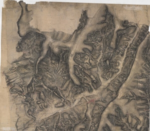
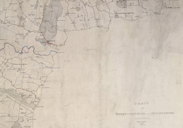
"The British Library is very fortunate in possessing 351 of the original preliminary drawings made by the surveyors between the 1780s and 1840. They cover most of England south of a line between Liverpool and Hull. The collection includes maps drawn by Robert Dawson, perhaps the most talented of the draftsmen, whose work set the style for British military map making. His Survey drawings of North Wales show his skill at its best."
Amazing detail and documentation on a huge 1" to 1 mile scale.
Its amazing to think that these functional drawings were used as precious objects to consult about the lay of the land.
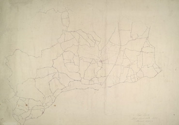
I particularly like the unfinished map of Eye (right) - the sparsity of the marks.
